
Trace a Belmont Street, Step by Step
A street directory search in Belmont works best as a sequence, not as one name box. Start with a physical address. Move from address to parcel and the best available owner source, then from owner to deed, from deed to approved voter information, and from voter evidence to historic directory listings. That order keeps land identity separate from a person’s current presence. ACRE, the San Mateo County Assessor-County Clerk-Recorder & Elections agency, holds the county property, deed, and election channels, while Belmont Community Development holds permit evidence.
- Address. Enter the street address in ACRE Property Maps or the secured tax search. Record the APN, situs components, and available parcel map references.
- Owner. Check the actual assessment or tax result, or confirm it through a lawful roll or counter source. The published map layer is not a public owner-name directory.
- Deed. Search the owner or entity as grantee in RecorderWorks, open the acquisition metadata, and then follow the seller as grantor.
- Voter. Use California My Voter Status only for the voter’s own authenticated lookup. A street-wide file requires an approved purpose and request.
- Directory. Compare the address with reverse or criss-cross volumes, reading each annual abbreviation key before drawing a conclusion.
Belmont Street Records by Address
Belmont street records are split among county, city, election, and historical custodians. The table shows each channel’s use and limit. Property Maps and GIS are free informational tools. RecorderWorks supplies free metadata; images and older books require another path.
| Record Set | Keeper | Street-Level Answer | Access |
|---|---|---|---|
| Property maps and tax search | San Mateo County ACRE | APN, situs, assessment and tax-account leads | Free address or APN search |
| Parcel and zoning map | Belmont Maps and County GIS | Parcel geometry, adjoining parcels, zoning and land-use context | Free informational viewer |
| Deeds and liens | ACRE Recorder | Grantor, grantee, instrument type and recording dates | Free index; counter or paid copies |
| Permits and projects | Belmont Community Development | Dated work, applicant and project history | Registered eTRAKiT; counter files |
| Voter information | San Mateo Elections | Registration address only through approved channels | Self-lookup or qualified request |
| Reverse directories | Libraries and history repositories | Listed subscriber and address at a survey date | Catalogs, scans, or in-person research |
No row is a complete household roll. The same APN can support a map and deed, while a street name can appear in voter or directory records with a different date and coverage rule. Keep the source and date beside each result.
Belmont Property Maps, Field by Field
ACRE Property Maps and the County Property Information Portal are free informational viewers. Property Maps can search an address, a nine-digit APN, an assessor book and page, or a parcel or subdivision map reference. Downloads are free. The published parcel layer exposes APN and situs-address components, not a public owner-name directory. A tax search accepts an address or APN and should be treated as a separate check.
The ACRE Assessor Maps search shows the map modes that help turn a Belmont street address into a parcel key.
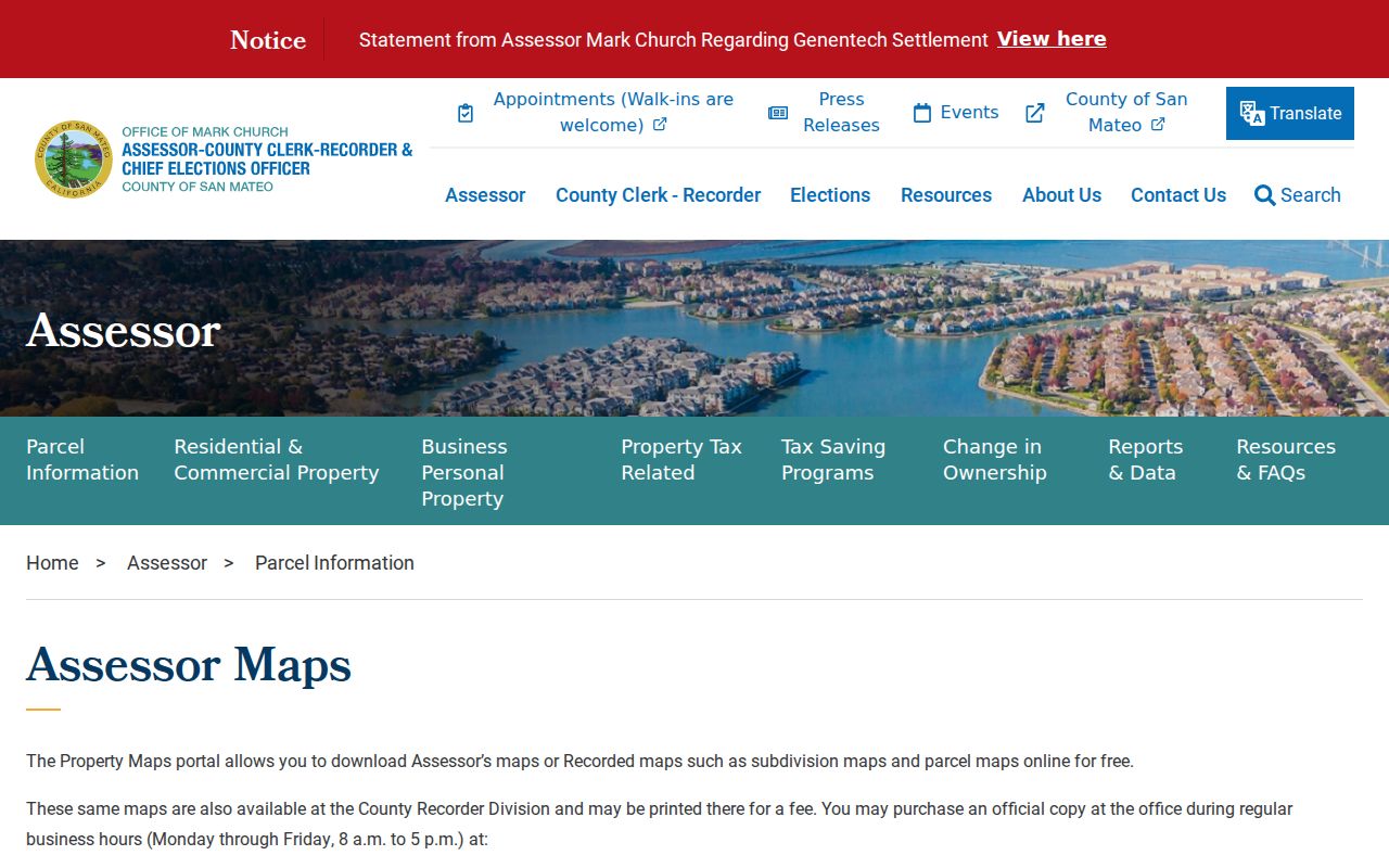
The result links to free map downloads. It supports land identity, not proof of who is present at the address.
| Field or Mode | Type | Required | Belmont Format or Note |
|---|---|---|---|
| Find parcels by ADDRESS | Mode or icon | Alternative | Choose the address mode, enter the street address, then search |
| Address | Text | Yes in address mode | Use the situs address tied to the parcel |
| Find parcels by APN | Mode or icon | Alternative | Choose APN search when the parcel number is known |
| APN | Text | Yes in APN mode | Nine digits, with no dashes |
| Assessor Maps | Property Maps mode | Alternative | Assessor book and page search |
| Parcel or Subdivision Maps | Mode choice | Alternative | PM or RSM, then volume and page |
| Result links | Link controls | Not applicable | Assessor Map, available recorded maps, and map-name download |
Belmont GIS Parcels and Street Browsing
The Belmont Maps and Data hub connects a local parcel and zoning viewer with San Mateo County GIS. Zoom and pan along a street, click adjacent parcel polygons, and note each APN before opening its map or tax record. The viewer can add parcel geometry, zoning, land-use context, and adjoining-parcel relationships to a street directory search. It remains an informational viewer, not title evidence, and popup fields must be checked interactively.
The San Mateo County public property viewer demonstrates the parcel layer used for street-by-street map browsing.
There is no stable official manual confirming a buffer, radius, or measure tool, so a street search should rely on visible parcel selection rather than promised radius controls.
From Belmont Address to Parcel Identity
Four terms prevent common mix-ups in Belmont street records. A parcel is the mapped unit of land identified by an APN. A situs address is the physical location assigned to that parcel. A plat is a recorded map showing parcel, lot, block, or subdivision relationships. A criss-cross directory is a reverse section that arranges listed subscribers by street and house number rather than by surname.
- Parcel
- The land unit tied to an APN, map polygon, assessment account, and available recorded maps.
- Situs address
- The physical location of the parcel. It is not the same as the address used for tax mail.
- Plat
- A recorded land map that can preserve lot, block, subdivision, and page references when street labels change.
- Criss-cross directory
- A street-order directory section listing the address and whatever subscriber or phone details that volume recorded.
The ACRE property-tax lookup helps test an address or APN against the tax channel. A mailing address may differ from the situs, so the durable land key remains the APN and legal description, not a guessed household name.
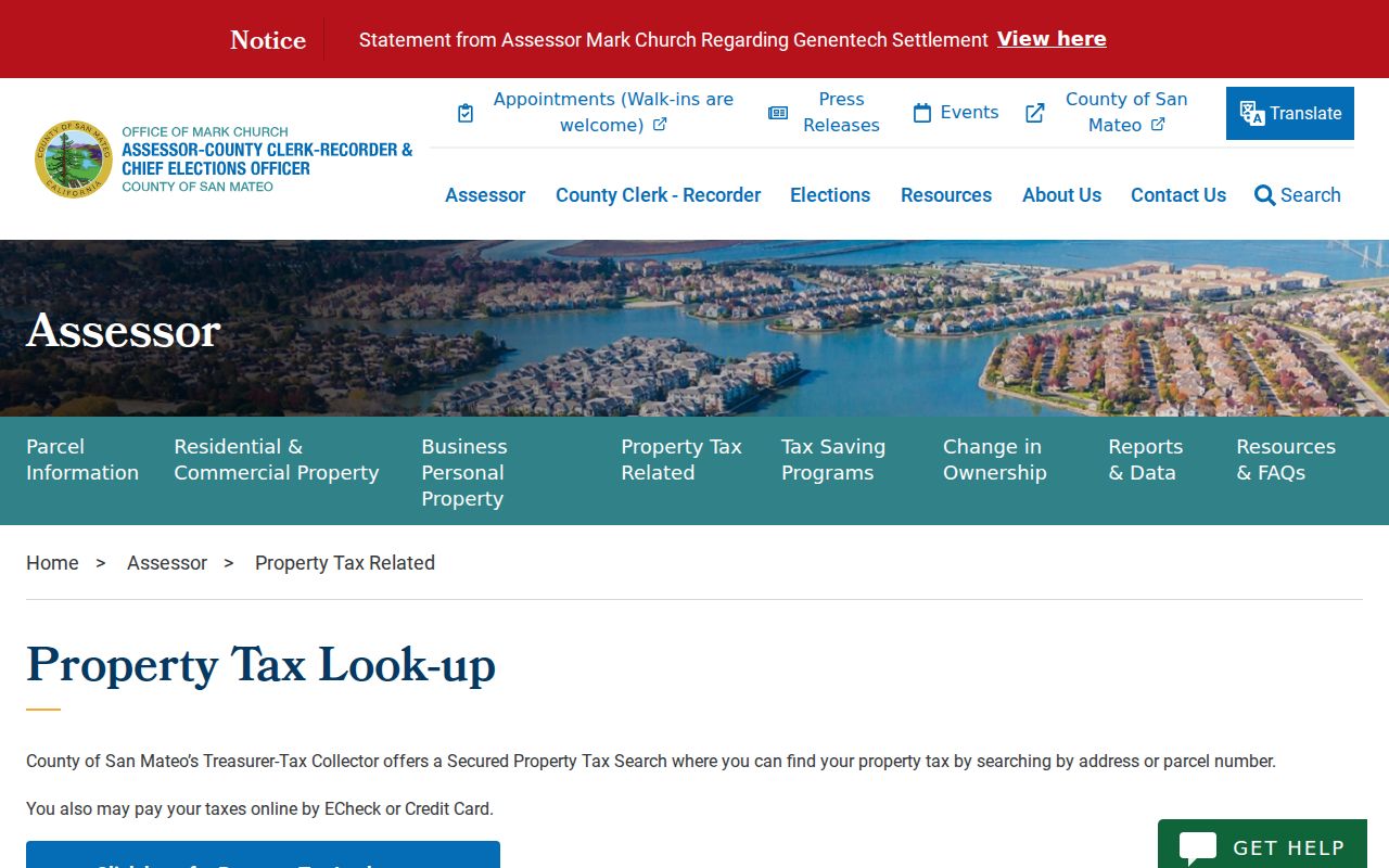
The address lookup leads to a parcel, not a person.
RecorderWorks Connects Deeds to Streets
RecorderWorks is ACRE’s online grantor-grantee index for San Mateo County property documents from 1985 to the present. Search by party name, document number, document type, map, recording date, book and page, or predefined search options. Name syntax is LAST FIRST, partial matching is available, and the party-role radio can be set to all, grantor, or grantee. The index is free, but online document images are excluded.
The RecorderWorks deed index shows the tabs and search controls used to connect a Belmont APN or owner name to a recorded instrument.
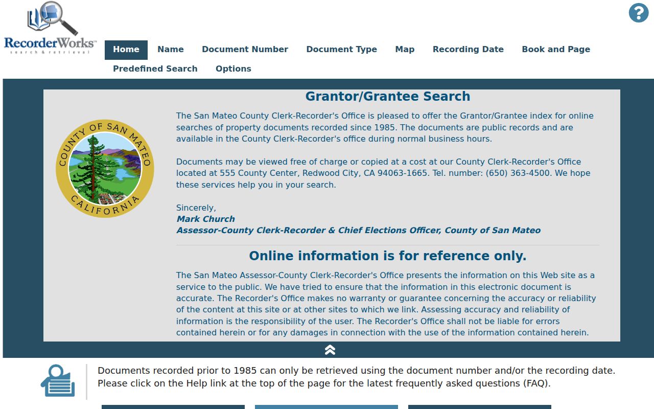
Clicking a document number opens metadata. Clicking a party name pivots to that party’s documents, grouped and sorted by type and recording date. Narrow a busy result set with date pairs, role, APN, or book and page.
| RecorderWorks Control | Type | Format or Use |
|---|---|---|
| Tabs | Navigation | Home, Name, Document Number, Document Type, Map, Recording Date, Book and Page, Predefined Search Options |
| Name and party role | Text and radio | LAST FIRST; All, Grantor, or Grantee |
| Allow Partial Match | Checkbox | Broadens a name search; a partial such as smith a is allowed |
| From and To | Date pair | MM/DD/YYYY, used to narrow the recording window |
| Map | Text | Nine-digit APN with no dashes |
| Book and Page | Text pair | Older record reference |
| Document Type | Selector | Paired with dates; the full live option list was not captured |
RecorderWorks returns:
- Party names and grantor or grantee role.
- Type, recording date, and document number.
- Page count and, for older instruments, book and page.
- No linked image; online images are excluded.
- Reference data, not a title opinion or resident list.
Examples include deeds, deeds of trust, liens and releases, maps, court decrees, commercial financing statements, and mechanics liens.
Permit Files Date Belmont Street Changes
Belmont’s eTRAKiT system adds a city-side timeline. A registered public user can search building, planning, and public-works permits and project information, plus tree-removal and alarm permits. Registration is required for public searching. The online application list is narrower than the search scope, and “View Property Files” matters when older plans or inspection cards are not online.
For in-person fallback, the Belmont Permit Center is at the first floor of Belmont City Hall. Walk-in hours are Monday, Wednesday, and Thursday from 8:30 to 11:30 a.m. Building and permit questions go to 650-595-7422 or permitcenter@belmont.gov; planning uses 650-595-7417 or cdev@belmont.gov; Public Works uses 650-595-7425 or pworks@belmont.gov. A permit can connect an address to a dated applicant, architect, contractor, owner, project scope, valuation, review, or inspection event. It does not enumerate everyone associated with the address.
Belmont Street Names Across Time
Old labels can be the reason a Belmont street directory search appears empty. Historical sources may use The Corners, Four Corners, Angelo’s Corners, Waterview, or Flashner’s Corners. Old County Road aligns with present El Camino Real, while Cañada del Diablo roughly follows Ralston Avenue. Belmont took hold as a place name around 1853, the post office dates to 1854, and the city incorporated in 1926.
No verified citywide renumbering year was found. When a historic address does not match a modern street, retain the original wording, test the APN or legal description, compare a plat, and ask Belmont Community Development or Public Works about addressing history. Pre-1856 land work can also cross Rancho de las Pulgas, San Francisco County, and San Mateo County records.
Belmont Voter Records Need Authentication
California My Voter Status is a self-lookup, not an open street directory. It asks for first name, last name, full date of birth, and either a California driver license or ID number or the last four digits of a Social Security number. The “I do not have” choice is available for the identity fields. The encrypted result can show registration status and address, party preference, language preference, vote-by-mail or provisional status, polling or vote-center details, upcoming election information, county contact, and voter-guide delivery preference. A recent online registration may need 24 hours before the lookup works.
San Mateo County election data is not a public browse by street. A qualified requester can apply for a voter information file with a written Secretary of State application, payment, identification, and an approved election, scholarly, journalistic, political, or governmental purpose. In-person requests use a driver license at Registration & Elections, 40 Tower Road, San Mateo, California 94402. Mail requests use a signed application, payment, and photo ID copy. The voter information file costs $125; a printed list costs $0.50 per 1,000 names. Questions go to data@smcacre.gov or 650-312-5222.
The file may contain residence or mailing address, precinct, party, status, registration date, and participation history, but not ballot choices. Driver license, Social Security, unique ID, and signature data remain confidential. Safe at Home participants may register confidentially. The application forbids private or commercial use, harassment, solicitation, sale, marketing, and unauthorized online display. For a single person rather than a whole street, the Belmont resident lookup workflow keeps the election limits in view.
Reverse Directories Read Streets Backward
Historical reverse directories are the street-level layer that parcel and deed records lack. Documented Belmont material includes the Belmont Social Directory from 1899, a San Mateo County directory from 1911-1912, Polk’s Redwood City volumes from 1941-1942, 1950, and 1954, an Atherton and Belmont directory from 1954, and other county images from 1927, 1945-1946, 1948-1949, 1955-1956, and 1968. A 1948 San Mateo County telephone directory is also cataloged. These are useful waypoints, not a verified continuous run.
A reverse section may list street, house number, subscriber, and phone. The alphabetical section may add a spouse, address, occupation, or widow notation. Read the annual key first. A missing name can mean a move, a missed canvass, no telephone listing, age, publisher scope, or a spelling variation. The Belmont Library genealogy resources, San Mateo Main Library California Collection, San Mateo County Historical Association, California State Library, and FamilySearch form the practical repository trail. The Belmont city directory collections carry the fuller shelf and year-by-year research path.
The County Counter Has Missing Images
RecorderWorks metadata is free online, but ACRE deliberately omits document images for privacy. Public terminals at 555 County Center in Redwood City allow free viewing. The Recorder office is open Monday through Friday from 8 a.m. to 5 p.m.; call 650-363-4500 or email recorder@smcacre.gov. Staff preserve the archive, but a searcher must conduct the title research and should not treat acceptance of a document as legal advice.
Mail or counter copy requests need the parties, document type, recording date, and recording number from the index. Include payment and a self-addressed stamped envelope when mailing to ACRE, Attn: Customer Service Desk, 555 County Center, 1st Floor, Redwood City, California 94063. A regular copy is $5 for the first page and $1 for each additional page. Certification adds $5; a conformed copy is $10. The office terminal and a mailed copy answer different needs, so record the document number before leaving the free online index.
Where Belmont Street Records Stop
A parcel owner, tax mailing address, recorded party, registered voter, or directory subscriber is not a complete resident list. Parcel records do not name every household member. A voter file cannot be openly browsed by street, and DMV personal information and utility customer data are restricted. A different mailing address can point to a record mismatch, but it does not establish who is at the physical situs. Compare sources without turning an inference into a fact.
Lawful use. Belmont street and address records are suited to personal, lawful research such as family history, house history, and civic record checking. Do not use a name or address to stalk, harass, threaten, or harm anyone.